
Core Features & Benefits
- Ultra-Long-Range Capability
- Measures 6km/8km/10km/12km models with ±0.5m precision.
- Digital range gating (30-5000m adjustable in 10m steps) for precise targeting.
- Advanced Measurement Functions
- Calculates slope distance, horizontal/vertical distance, angles (±90°), and azimuth (optional electronic compass, 360°±1°).
- Dual-target measurement in one laser pulse + 81-data storage.
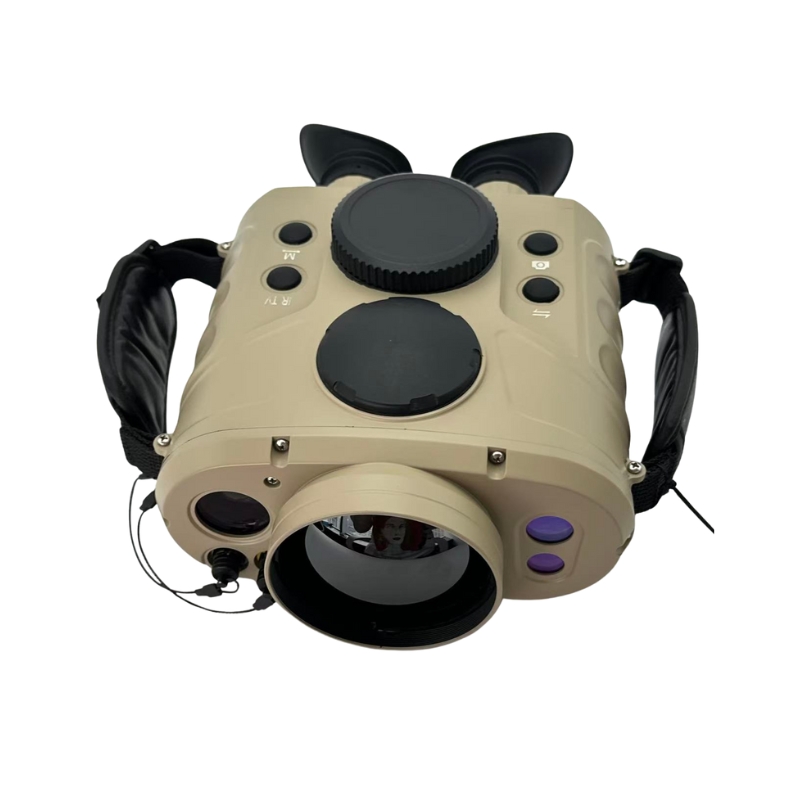
- Rugged Field-Ready Design
- Fully sealed metal housing (IP67 waterproof) withstands -40°C to +60°C and 95% humidity.
- Anti-shock construction for harsh environments.
- User-Centric Enhancements
- Backlit crosshair reticle for night operations.
- RS232 data interface for real-time measurement export
Technical Specifications
| Parameter | Specification |
|---|---|
| Ranging Performance: | |
| Laser Source | ND:YAG laser, wavelength 1064nm |
| Min. Range | ≤50m |
| Max. Range | 6km / 8km / 10km / 12km (model dependent) |
| Ranging Accuracy | ±0.5m |
| Ranging Rate | 12 times/min (continuous); 20 times/min (emergency mode: 1min work, 1min rest, cycle operable) |
| Range Gating | 30-5000m, adjustable in 10m steps, displayed digitally |
| Correct Measurement Rate | ≥98% |
| Inclinometer | ±90°, accuracy 0.1° |
| E-compass | 360°, accuracy 1° (optional) |
| Optical Performance: | |
| Magnification | 7x |
| Field of View | 6.5° |
| Exit Pupil Diameter | 5mm |
| Eye Relief | 20.3mm |
| Power & Data Interface: | |
| Power Supply | Two rechargeable lithium batteries (over 3000 measurements at 25°C per full charge) |
| External Data Interface | RS232 |
| Environmental Adaptability: | |
| Operating Temperature | -40°C to +60°C |
| Storage Temperature | -45°C to +70°C |
| Max. Humidity | 95-98% |
| Construction | Fully sealed metal housing, waterproof and shock-resistant |
| Dimensions & Weight: | |
| Dimensions | 160×150×66mm |
| Weight | 1kg |
Target Applications
- Military & Defense: Reconnaissance, target acquisition, border surveillance.
- Surveying & Construction: Topographic mapping, infrastructure planning.
- Forestry & Conservation: Canopy height analysis, wildfire assessment.
- Disaster Response: Search and rescue, hazard zone measurement.
Operation Process
- Aim: Align target using illuminated crosshair.
- Measure: Press laser button for instant distance/angle data.
- Store/Export: Save up to 81 targets or transfer via RS232.
Usage Precautions
Temperature Limits: Operate between -40°C to +60°C; store at -45°C to +70°C.
- Laser Safety: Avoid direct eye exposure to laser beam.
- Battery Care: Use only provided Li-ion batteries; recharge at 25°C for optimal lifespan.
- Cleaning: Wipe lenses with microfiber cloth; avoid solvents on metal housing.